|
|
|
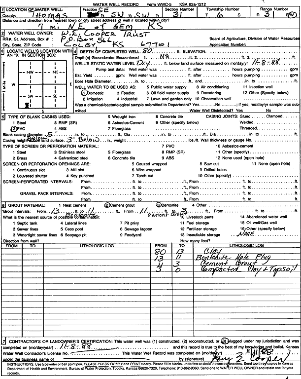
Specific Water Well Detail |
|
|
| Location Info | |||
| Owner: W.E. Cooper Trust | Status: Plugged | ||
| Location: T6S, R31W, Sec. 31, SE SW SW | County: Thomas | ||
| Directions: from Gem: 7 mi NE | |||
| Latitude: 39.4823168 | Longitude: -100.8282892 | Datum NAD 27 | |
| Latitude: 39.4823205 | Longitude: -100.8287172 | Datum NAD 83 | |
| Longitude and latitude calculated by Survey from township-range-section-quarter calls. Only good to within the quarter call accuracy. | |||
| View well on interactive map | |||
| General Info | ||
| Well Depth: 80 ft. | Elevation: ft. | |
| Static Water Level: ft. | Est. Yield: gpm. | |
| Comp. Date: 08-Nov-1988 | Well Use: Domestic | |
| DWR Applic. #: | Other ID: | |
| Driller Info | ||
| Driller: unknown | License #: | |
| Scanned Form | View scan |
| Casing Info | ||
|
Casing Type: PVC
Diam: 5 in. Casing height above land surface: in | ||
| Grout Info | ||
| Grout used: Cement grout, Bentonite | From: 3 to 11 ft
From: 11 to 13 ft From: 0 to 0 ft | |
| Source of Possible Contamination | ||
| Source: OTHER | ||
| Direction from well: | Distance: 0 ft | |