|
1
||
2
||
3
||
4
||
5
||
6
||
7
||
8
||
9
||
10
||
11
||
12
||
13
||
14
||
15
||
16
||
17
||
18
||
19
||
20
||
21
||
22
||
23
||
24
||
25
||
26
||
27
||
28
||
29
||
30
||
31
||
32
||
33
||
34
||
35
||
36
||
37
||
38
||
39
||
40
||
41
||
42
||
43
||
44
||
45
||
46
||
47
||
48
||
49
||
50
||
51
||
52
||
53
||
54
||
55
||
56
||
57
||
58
|
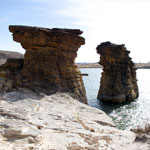
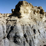
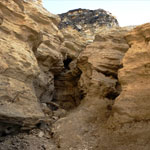
Dakota Sandstone Outcrops
|
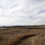
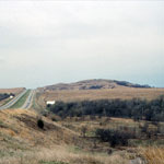
Trail to Rocktown Cove at Wilson Lake
|
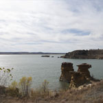
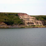
Rocktown Cove at Wilson Lake
|
Spalled Ogallala Formation Mortar Beds
|
Niobrara Chalk and Shale Banded Badlands
|
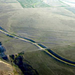
Soule Canal (Soule's Folly) and Santa Fe Trail Ruts (Aerial)
|
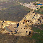
Sand Pit in Sand Hills (Aerial)
|
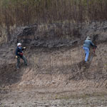
Geoarchaeologists on Big Blue River Bank
|
Buffalo Mound
|
Chalk Beds Near Castle Rock
|
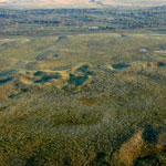
Stabilized Dunes (Aerial)
|
Ogallala Formation Outcrop at Clark State Fishing Lake
|
Dunes over Glacial Drift
|
Slope Collapse in Blue Hill Shale
|
Floodwater Cutoff Meander on Stranger Creek (Aerial)
|
Geoarchaeology Excavation Site
|
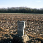
Santa Fe Trail Marker
|
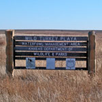
Wild Turkey Playa
|
|
1
||
2
||
3
||
4
||
5
||
6
||
7
||
8
||
9
||
10
||
11
||
12
||
13
||
14
||
15
||
16
||
17
||
18
||
19
||
20
||
21
||
22
||
23
||
24
||
25
||
26
||
27
||
28
||
29
||
30
||
31
||
32
||
33
||
34
||
35
||
36
||
37
||
38
||
39
||
40
||
41
||
42
||
43
||
44
||
45
||
46
||
47
||
48
||
49
||
50
||
51
||
52
||
53
||
54
||
55
||
56
||
57
||
58
|