| Folder No. | County Name City |
Scanning | TSR | Quadrangle | Lat/Long | Project | Dates | Miscellaneous | Range of sheets | No. of sheets |
Cabinet | Notes |
|---|---|---|---|---|---|---|---|---|---|---|---|---|
|
Sheet 1, No. 1115
View |
Grant
No city |
Scanned
(8 online) |
T. 29-30 S., R. 35 W. |
37.443553
-101.178374 |
CCR | 4-8-1939 | 34-J | 71:86 to 93 | 8 | 22 |
Click on any thumbnail to view a larger photo.
|
CCR-71-86
37.494472 -101.178766 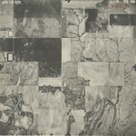
|
CCR-71-87
37.479253 -101.178066 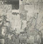
|
CCR-71-88
37.464511 -101.178874 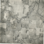
|
CCR-71-89
37.450813 -101.179075 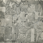
|
CCR-71-90
37.437418 -101.178516 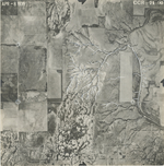
|
CCR-71-91
37.422292 -101.178276 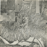
|
|
CCR-71-92
37.406819 -101.178 
|
CCR-71-93
37.392849 -101.177417 
|