| Folder No. | County Name City |
Scanning | TSR | Quadrangle | Lat/Long | Project | Dates | Miscellaneous | Range of sheets | No. of sheets |
Cabinet | Notes |
|---|---|---|---|---|---|---|---|---|---|---|---|---|
|
Sheet 1, No. 251
View |
Butler
El Dorado |
Scanned
(7 online) |
T. 25-26 S., R. 5 E. | El Dorado |
37.809415
-96.816165 |
GS-VENV | 3-21-1978 | Flights 1 and 2 N.S. 20,000 | 1-50 to 1-52/1-65 to 1-68 | 7 | 5 | See El Dorado Index Sheet and Rosalia w/2 |
Click on any thumbnail to view a larger photo.
|
GS-VENV_1-50
37.774078 -96.781388 
|
GS-VENV_1-51
37.810447 -96.782386 
|
GS-VENV_1-52
37.843924 -96.779771 
|
GS-VENV_1-65
37.85773 -96.840477 
|
GS-VENV_1-66
37.825976 -96.841099 
|
GS-VENV_1-67
37.794516 -96.844055 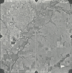
|
|
GS-VENV_1-68
37.759231 -96.843977 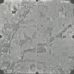
|