39.819489
-94.864886
39.80475
-94.866469
39.791739
-94.867383
39.778211
-94.866652
39.76351
-94.865556
39.747681
-94.865068
39.734472
-94.866226
39.720042
-94.865678
39.704813
-94.868053
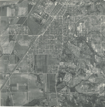
| Folder No. | County Name City |
Scanning | TSR | Quadrangle | Lat/Long | Project | Dates | Miscellaneous | Range of sheets | No. of sheets |
Cabinet | Notes |
|---|---|---|---|---|---|---|---|---|---|---|---|---|
|
Sheet 1, No. 776
View |
Doniphan
St. Joseph (MO) |
Scanned
(9 online) |
T. 3 S., R. 23 E. | St. Joseph N, St. Joseph S. |
39.762745
-94.866219 |
GS-YZ | 10-11-1941 | 22-14 | 4B-65 to 4B-73 | 9 | 15 |
Click on any thumbnail to view a larger photo.