| Folder No. | County Name City |
Scanning | TSR | Quadrangle | Lat/Long | Project | Dates | Miscellaneous | Range of sheets | No. of sheets |
Cabinet | Notes |
|---|---|---|---|---|---|---|---|---|---|---|---|---|
|
Sheet 1, No. 788
View |
Doniphan
No city |
Scanned
(8 online) |
T. 2 S., R. 21 E. | Forbes, Troy |
39.881358
-95.048076 |
GS-CFP | 12-26-1957 and 12-4-1957 | 4B 110-111; 4F 109-110; 1B 74; 1F 73; 1F 84; 1B 85 | 8 | 15 |
Click on any thumbnail to view a larger photo.
|
GS-CFP-1B-73
39.880986 -95.060146 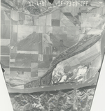
|
GS-CFP-1B-74
39.880986 -95.060146 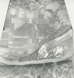
|
GS-CFP-1B-85
39.879297 -95.09749 
|
GS-CFP-1F-84
39.879297 -95.09749 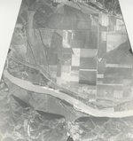
|
GS-CFP-4B-110
39.862569 -95.015836 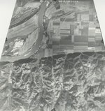
|
GS-CFP-4B-111
39.90258 -95.018831 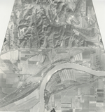
|
|
GS-CFP-4F-109
39.862569 -95.015836 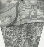
|
GS-CFP-4F-110
39.90258 -95.018831 
|