| Folder No. | County Name City |
Scanning | TSR | Quadrangle | Lat/Long | Project | Dates | Miscellaneous | Range of sheets | No. of sheets |
Cabinet | Notes |
|---|---|---|---|---|---|---|---|---|---|---|---|---|
|
Sheet 1, No. 849
View |
Edwards
No city |
Scanned
(19 online) |
T. 25-26 S., R. 18-20 W. | Kinsley SW, Centerview |
37.803341
-99.399797 |
GS-VCPK | 3-30-1971 | EW 10000 | 1-109 to 95 odds, 104, 102, 41 to 27 odd, 34 | 19 | 16 |
Click on any thumbnail to view a larger photo.
|
GS-VCPK-1-27
37.759057 -99.483642 
|
GS-VCPK-1-29
37.759939 -99.441642 
|
GS-VCPK-1-31
37.759057 -99.398775 
|
GS-VCPK-1-33
37.758351 -99.356969 
|
GS-VCPK-1-34
37.757645 -99.332857 
|
GS-VCPK-1-35
37.787028 -99.342569 
|
|
GS-VCPK-1-37
37.786587 -99.38577 
|
GS-VCPK-1-39
37.788177 -99.429873 
|
GS-VCPK-1-41
37.786587 -99.471873 
|
GS-VCPK-1-95
37.816201 -99.480904 
|
GS-VCPK-1-97
37.815623 -99.440379 
|
GS-VCPK-1-99
37.816411 -99.398379 
|
|
GS-VCPK-1-101
37.818617 -99.355841 
|
GS-VCPK-1-102
37.818735 -99.332553 
|
GS-VCPK-1-103
37.847329 -99.332503 
|
GS-VCPK-1-104
37.847329 -99.354245 
|
GS-VCPK-1-105
37.847526 -99.37524 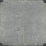
|
GS-VCPK-1-107
37.846542 -99.418027 
|
|
GS-VCPK-1-109
37.846738 -99.464105 
|